WCA Triumph: the Highway Widening--1996-2000
Feasibly the biggest contribution made by
 |
| An aerial shot of South Warrimoo after the 1968 fire--note how the Highway houses abut the Highway, and the distance between the Highway and Railway--the main road was much narrower then, and not much wider than The Avenue and The Boulevarde. |
Warrimoo, in fact, was well placed to deal with the juggernaut. It possessed a Citizens Association duly elected and recognised as representing the township. Many Mountains settlements do not have such a body, or instead have a 'Chamber of Commerce' which represents retailers, but not necessarily residents. While it was one of the first townships to experience the disruption of road construction, it also had the opportunity to be a 'trendsetter' for villages further on--it all depended on whether RTA were eager to please, or eager to finish quickly, ramming work through regardless. Throughout its progress, Mountains' residents got a taste of both, but Warrimoo was lucky.
As it eventuated, both the RTA (Roads and Traffic Authority--now the 'RMS--Roads and Maritime Services',) and the Citizens Association were intent on having the widest consultation possible, so when RTA 'feelers' were put out in early 1992, the WCA responded with a leaflet drop to all letterboxes and notification to all the 'institutions' of Warrimoo: the Fire Brigade, the schools, shopkeepers, churches and sporting clubs. The principle concerns at the outset were:
What special interest do the residents have?
What can be done to enhance the work to our benefit?
What is the best way to get the people involved?
Previously the community had already discussed:
· Overhead bridge or tunnel for pedestrian traffic
· Second set of lights at the Boulevarde
· No barrier fence in the median strip opposite the shops
· Buy old garage site for parking
· Better exit from the Highway to the Fire Brigade and Hall
· Noise pollution - Road Surface, Embankment, Tree Planting
· Traffic Exit from Railway Parade - Underpass
· Parking facilities at or near shops
· Upgrading Entrance/Exit to
Possible Extras:
·
· Landscape from East of the shops to
· Landscape Median Strip
· Expansion of parking for possibly two more shops
 |
| WCA executive members and residents discuss proposed changes to Highway dimensions with the RTA 'On Site Engineer' |
· RTA overview Supervisor from Head Office Blacktown
· RTA Resident on site Engineer
· RTA Liaison: Ian Scott
· BMCC Officer with Oversight for the Project
· WCA President,
· Liaison Officer, RTA/Community
· WCA Member, Lex Bewley (Landscape Architect NSW Hons)
These Meetings proved their worth and many new ideas originating from Residents were implemented...
 |
| The Great Western Highway as it appeared in the 1960's--note the closeness of the road verge to houses, the width of Ardill Park, and 'Hurley's Butchery' in the distance (now 'Whimsical Notions' Antiques') |
Service Roads
The first was a bonanza for the residents facing two new Service Roads: one East of the Village to the old Ampol site, from the shops to The Avenue; the second from the Western end of Railway Parade to
The Village Shopping Centre
 |
| 'Village Centre'--looking from 'Big Shop' angle. Notice the old rubbish bin, the 'Bills Water Trough' and the absence of a 'Commuter Car Park'! There was a toilet block in the clump of trees to the left, but it is hard to make out. |
The shops were the big winners, two entrances from the Highway instead of one and parking for 22 vehicles in front of the General Store/ Post Office and 12 spaces in front of the Antique Shop.
 |
| The shops precinct immediately after completion of the GWH , with fresh plantings and parking spaces. The Liquor store was once 'Turnbull's Real Estate' |
 |
| The 1960's--the 'Big Shop' directly opposite the old Tennis Courts and station. The tiny chemist shop beneath the 'Peters Ice Cream' sign is barely visible. Parking to visit the shops was on the verge of the road. |
 |
| The same beautiful building as it stands today: "Monte Italia Pizzeria" minus the little chemist shop. |
The Warrimoo Hall
Due to direct entrance from the Highway being blocked and the Highway moved much closer to the front, thus eliminating the old entrance steps to the Hall, RTA paid for and built the:
· Access ramp to the front of the hall from the WVFB/ WCA car park
· Enclosure for the veranda and entrance doors at the front of the Hall
· Double glazed windows on the Southern and Western sides of the Hall
· Air circulation installation and heating equipment in the Hall
· Improved car parking around the hall making 18 places.
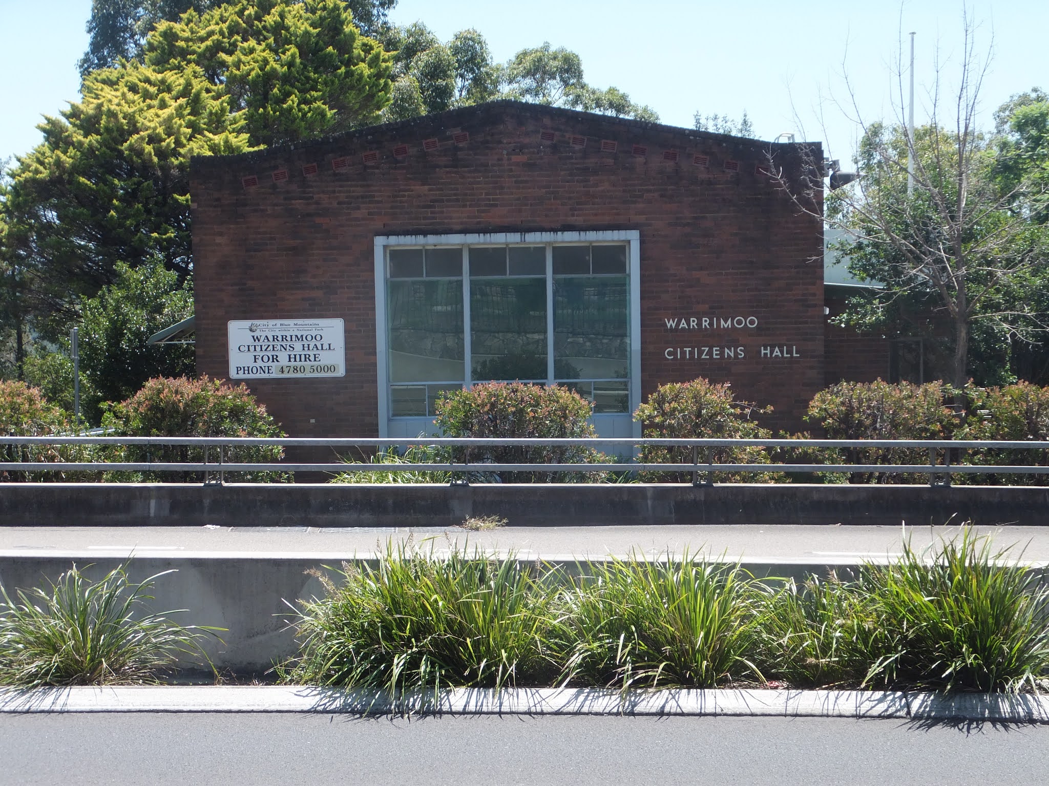 |
| The Warrimoo Citizens Hall was 'cramped up' by the new GWH--parking at the front was no longer possible, so Eley-Hawkins Drive went round the back, and 18 nominated parking spots were made available for both the Hall and the Fire Brigade HQ. |
Though WCA had little to do in the restructuring of the Fire Brigade Hall Executive members did sit in on meeting with the Brigade Executive, RTA and BMCC when alterations to the Brigade Hall and surrounding area, particularly the
Ardill Park
It was initially intended that
The Association persuaded RTA to provide two Shelter Sheds of our design to be positioned in the Park. RTA also provided three Bus Shelters, two in the Village area and one on the Service road towards
Jersey Barrier from The Boulevarde to the Fire Brigade Hall
This jersey strip had been only partially completed stopping short of the
Immediately the first section of the parapet was constructed it raised an outcry from residents who rightly called it the “prison wall” that was visibly dividing the Village. Our Representative
 |
| Once you could access Ardill Park all along, directly from the Highway--changes meant that this retaining wall had to be built, and special 'bridge-style' railing placed on the jersey barriers, instead of bald concrete. |
This type of parapet had the full support of the WCA and many other residents who had viewed it. The circular rails which were more attractive were, at the time, considered impractical by RTA, but under strong pressure from our reps this type of railing was ultimately incorporated into the works program. It extended several metres east of the Service Road exiting opposite The Boulevarde and up to where it terminated in the vicinity of the Citizens/Fire Brigade Halls.
Corridor of Trees - Sun Valley and East Valley Heights
The road reconstruction as it proceeded West beyond the overhead rail bridge opposite The Avenue would need to remove a strip of mature trees forming a median between the East and West bound lanes. The trees were ideally suited for the median strip but space would not allow their retention with the four traffic lanes proposed.
Lex Bewley put forward an idea that a strip of railway vacant land be acquired and the new west bound lanes moved 20 metres South, thus leaving the mature trees to form the median. This was eventually done and the corridor of trees between the East and West lanes now enhance the road in this area.
The Pedestrian Bridge
The design for the proposed Bridge was controversial and none of the plans submitted by RTA were acceptable in their present form, a decision was not made at the first meeting where the bridge was discussed, hence delaying a decision until the next meeting. Lex Bewley would hold discussions with some of his engineering friends and obtain designs of bridges in
 |
| View from the Bewley Bridge down the GWH. Note the "W", 'Circle' and 'Star' signs punched from the pedestrian bridge's railing--a unique feature. Some of the wonderful callistemons seen below have been replaced with jersey barriers in an 'upgrade' carried out in 2016. |
Consequently Lex Bewley presented several drawings of bridges he obtained from Magazines at
 |
| Lex Bewley's suggested Art Deco 'pylons' are an artistic 'nod' to the Sydney Harbour Bridge and make the Bewley Bridge something more than just a 'footbridge'--it soars like a song from the people of Warrimoo. |
Soaring artistically, it is rightly recognised as the best in the Mountains and contains in its steel railing three punched icons representing Warrimoo: a circle, a star and a delightful 'W', unique to our bridge. It is often referred to as the great '
 |
| The Bewley Bridge soars skywards and invites Warrimooians to observe cosmic events like lunar eclipses from its pathway. |
North – South Underpass
The North – South Underpass was shown on the original concept plans drawn up by RTA. It was essential for the interchange of vehicles between North and
WCA immediately challenged this decision and sought the help of Bob Debus, our local State Member, to obtain extra finance for building the underpass. Much to his credit he obtained the extra money for the underpass to be reinstated into the project.
(*As a footnote it is important to acknowledge the death of a workman whose front-end Digger rolled down the rail embankment and crushed him during the underpass construction. The WCA sent a condolence letter to RTA and his family after this tragic event).
 |
| Warrimoo's 'second underpass', which kept the 'two halves' of Warrimoo together. No other township on the Mountains was able to secure such a feat, avoiding traffic lights and feasibly, many fatal accidents. |
The completed project meant that TWO underpasses, one under the GWH and running next to the Hall and FB Headquarters providing safe access for residents seeking eastward entry/egress; and another under both the Highway and the Rail line to maintain connection between North and South Warrimoo, had been attained.
 |
| The 'Double Underpass' is cordoned off in preparation for its formal opening. |
 |
| The original plan for the underpass was deleted by the RTA as a cost-cutting measure, but after representations from WCA, local MLA Bob Debus lobbied successfully to provide the required funds for its completion. |
No other village/township in the Mountains was able to achieve this 'double solution'--viva Warrimoo!
Motifs embedded in GWH
The motifs on the road barriers in the Village depict three man-held pack horses headed West. They are etched into seven of the westward concrete barriers symbolizing the European crossing of the Mountains. The etched barriers start at the eastern side of the overhead bridge. These “drawings” were the brainchild of Lex Bewley to create a distraction from (what are otherwise ugly) bare concrete barriers. They are intended to show a little of our past history when Wentworth, Blaxland and Lawson passed through Warrimoo in 1813.
 |
| Imprinted silhouettes on the Jersey Barriers underside the Bewley Bridge--they represent the Crossing of the Mountains by Blaxland, Wentworth and Lawson in 1813, and are unique to Warrimoo. Exhaust fumes and weathering have obscured the motifs, but they are still there and it is WCA's ambition to make them clearly visible again. |
These items were another victory to enhance the Village. It was fortunate we had a Landscape Architect as a member of the WCA. RTA actually listened to his professional suggestions.
Land Scaping the Project
Nearly a million dollars was allotted in the budget for land scaping the Highway through Warrimoo. We were very aware of the “not too successful” landscaping of the M4. We persuaded RTA that a Landscape Architect of our choice be given the task of landscaping the Road Widening Project through Warrimoo. RTA suggested we submit three names to them to choose the person. This was done and WCA lobbied discreetly for Maryanne Schell, who was indeed chosen for the role.
Maryanne did extremely well in meeting our expectations and her work is readily visible in the area where the Road Widening took place--the beautiful Callistemon ('Bottlebrush') plantings and the stand of Turpentines and assorted trees between the shops and the Warrimoo sign on the Eastern end, are a couple of examples (regrettably Maryanne died of cancer three years after completion of the Warrimoo section).
Guided Tours
As a goodwill gesture in the middle of the widening project, RTA offered to provide a guided tour of construction progress in June, 1997. Numerous residents responded enthusiastically, and were treated to a dramatic walk via burgeoning Service Roads to Warrimoo's unheralded wetlands, Aboriginal caves, park improvements and new bridge vantage points, all the while being informed about costs and completion dates--overall, it was estimated that the cost of the two-laned Highway through Warrimoo would be roughly $50m.
Penultimately, near completion, a 'Final Walk' around the construction site was carried out by RTA liaison rep. Ian Scott and WCA President
 |
| Member for the State seat of Blue Mountains, Bob Debus, formally opens the newly completed section of Highway in December 2000. He is proudly accompanied by BMCC Councillor Angelique Henson, and WCA Executives Trish Mungoven and Allan Bewley. |
Success in such 'public relations' exercises with Warrimoo residents can be measured in the sheer number of interested onlookers who turned up to watch hallmark events such as insertions of the final pieces of Rail and Pedestrian Bridges--carried out with a Highway blockade and huge cranes--as well as the final opening/celebration of the completed section by Bob Debus in December, 2000.
Overall, the Highway Widening through Warrimoo was testament to a wonderful collaboration between the Citizens Association and a huge State instrumentality, the (then) RTA. What a pity relations were soured some twelve years later when the (now) RMS decided to ram through the installation of extra concrete jersey barriers on the western median strip, with little or no consideration for the loss of callistemon (bottlebrush) plants and landscaping that this entailed--it was struggle enough for the WCA to save the callistemons that remain today!
Great little Chapter in Local History, So good to see what Consultation, Cooperation and Collaboration' can Achieve for all when the effort is put in.
ReplyDeleteWell Done to all concerned.